
This is a toll road, clearly signposted from the village of Altaussee. A public road leads northeast (this bit is one-way) from the centre of the village. At the end of the one-way system is a junction left, leading over the river to a further junction right to the tourist Salt-mine, and left back to the village.
Straight on (now two-way), leads uphill, often narrow, to a further junction. Straight on here is a deteriorating track to Blaa-Alm, offering a restaurant with Reininghaus bier, excellent views of the cliffs NW of Loser, and an aerial ropeway intended for kids, but well worth playing on for groups of inebriate cavers. This is also the approach for the Naglsteghöhle and resurgence - outside our area, but worth a visit.
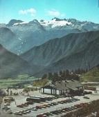
Right at the junction is a metalled road, the Loser Panoramastraße, which immediately has a toll-gate (and often the queue for this blocks the main road). This is only manned during daylight, when tourist traffic is expected. The road leads steeply up, with numerous hairpins, first to the Loser Hütte, 550m above the start. This was once a relatively isolated mountain hut, but now serves as a convivial lunchtime and evening hostelry - it was rebuilt as "Hotel Loser" for 1995. Beyond the old hut, the road continues to a new (in the mid-seventies) Bergrestaurant, only open during the day, and with a huge car park, full of tourists whenever the weather is half decent. The area is also a small ski resort in the winter, and various lifts line the hillsides.


The cost of the toll road is fairly reasonable if you want to make one trip for the view, but quickly becomes prohibitive for a caving expedition made up mainly of impoverished students needing to make a dozen or more return journeys. Cyclists go free, but 900m of ascent from the village is a little excessive with heavy gear. It does make a splendid run back down, however ! Trying only to travel at night is possible, but is both underhand and rather restrictive, particularly if an emergency arises. Permission is needed to camp within the Nature Reserve at the top, so it is best to negotiate a cheaper deal. The owner is very interested to know about the caves on "his" plateau, so it's important to send a report as soon as possible after the expedition.
Familiarity soon breeds contempt, and typical expo drivers don't spend much time looking at the view after the first couple of trips. This style of driving, combined with visits at quiet times of the day/night, tends to result in some fairly quick trip times. For those wanting to do comparisons, timings are between the "stop" line across from the toll booth at the bottom, and the drainage line (looks like a narrow cattle grid across ¾ of the road) at the west end of the car park. We don't recommend speeding through the car park owing to the propensity of tourists to wander around looking at the views, not the traffic :-)
| Vehicle | Time up | by | Time down | by |
|---|---|---|---|---|
| Bike | 01:15:00 | Justin (1992) | 00:09:26 | Clive George |
| Car | 00:07:46 | Andy Waddington (1998) | 00:07:30 | Andy Waddington (1998) |